In 1086, twenty years after the Battle of Hastings, William the Conqueror's clerks wrote down who held almost every estate in England, what it contained and what it was worth. The result was Domesday Book. For Derbyshire, it is the earliest detailed record of who held the land, who worked it and what it produced.
What Domesday Book is
At Christmas 1085, William held his great council at Gloucester and ordered a survey of his kingdom. Commissioners went out county by county and asked the same questions of every estate. Who held it in the time of King Edward, before the Conquest, and who holds it now? How much land is there, and how many people work it? Is there a mill, meadow or woodland? What was it worth then, and what is it worth now?
The answers were written up in Latin, and the survey was complete by 1086. It names more than 13,000 settlements across England. Its main purpose was to show the king what his kingdom held and what it could pay in tax. Within a century the English were calling it Domesday, after the Day of Judgement, because there was no appeal against what it recorded. The original volumes are kept at The National Archives at Kew.
Derbyshire's entries show the Conquest in its sharpest form. In the estates below, land once held by English lords such as Earl Algar, Siward and Tochi, or by King Edward himself, was by 1086 in the hands of King William, Burton Abbey, Henry de Ferrers or William Peverel.
What these Derbyshire entries show
In Domesday Book, the royal manors of Bakewell, Ashford and Hope rendered £10 6s in 1086. Their earlier obligations had included £30, honey and cartloads of lead. At Sudbury, a mill rendered six shillings and a hundred eels. These entries record how Derbyshire estates supported their lords through money, agricultural production and local resources. See VCH Derbyshire, p. 333 and the Sudbury entry on p. 339.
The survey also records uneven changes in value. Repton with Milton fell from £15 to £8, while Weston-on-Trent rose from £8 to £16. Other holdings were described as waste. Read together, the entries reveal changes in landholding and estate income after 1066, though they rarely explain the causes.
For individual locations, start with Aubrey’s Derbyshire Domesday records. The examples below compare selected holdings rather than provide a complete county gazetteer.
The words you will meet
Domesday uses terms that need explaining. These are the ones in this article.
- Manor: an estate held by a lord, farmed by people who owed him rent, labour or produce.
- In the time of King Edward: before the Conquest. These figures describe the estate in 1066.
- Rendered: paid. Some royal manors paid a fixed sum, sometimes with goods such as honey or lead.
- Sestier: a measure used for honey.
- Geld: the land tax.
- Carucate: the unit Derbyshire used to assess land for tax. In principle it was the land one team of eight oxen could plough in a year, but it was a tax rating, not an exact measurement.
- Plough team: eight oxen pulling a plough. Domesday counts the teams actually at work, which can be fewer than the land was rated for.
- Berewick: an outlying farm or hamlet that belonged to a larger manor.
- Villagers and smallholders: the main groups of peasants. Villagers held more land; smallholders were poorer, with little more than a cottage and a plot. Only heads of household were counted, so the real population was larger.
- Waste: land producing little or nothing for its lord. Domesday rarely says why.
Two cautions help too. A payment made by a group of royal manors together is not the value of any one of them. And a church or mill listed in 1086 does not mean the building standing today is that old. The National Archives guide to Domesday Book explains how to find and read the original entries.
Selected estate valuations before and after the Conquest
These figures are not prices, and they are not what the land would be worth today. Domesday gives each estate's value to its lord: what it was worth to him each year, in rents, produce and dues. Money was counted in pounds, shillings and pence. Twelve pence made a shilling and twenty shillings made a pound, but the only coin in use was the silver penny; pounds and shillings were units for counting. So "60s" means sixty shillings, or £3, and Repton's £15 meant 3,600 silver pennies a year. There is no reliable way to turn these sums into modern money.
| Holding or estate | Value in 1066 | 1086 value | Comparison |
|---|---|---|---|
| Repton with Milton | £15 | £8 | Down about 47% |
| Weston-on-Trent estate | £8 | £16 | Up 100% |
| Mickleover estate | £25 | £10 | Down 60% |
| Scropton estate | £8 | £10 | Up 25% |
| Sudbury holding under Alcher | 60s | 20s | Down about 67% |
Earlier values refer to the time of King Edward. These are the holdings described in the cited entries, not necessarily totals for every holding associated with a modern settlement. Percentages are calculated from the recorded amounts; £1 equals 20 shillings. Sources: VCH Derbyshire, pp. 332, 334, 338 and 339, linked in the relevant sections below.
Royal lead estates at Bakewell, Ashford, and Hope
 Jeremy Atherton / CC BY-SA 2.5 / Wikimedia Commons
The entries for Bakewell, Ashford-in-the-Water and Hope describe extensive royal estates. Bakewell had eight berewicks and 18 carucates assessed to the geld. Ashford had 22 assessed carucates and another exempt from geld, while Hope had ten assessed carucates. The VCH translation on page 332 lists their dependent holdings and resources.
Their collective render had included £30, five and a half sestiers of honey and five cartloads of lead described in slabs. In 1086, it was £10 6s, with William Peverel in charge. The continuation on page 333 records the payment; it does not explain why its amount and composition changed.
Bakewell and Ashford each had a plumbaria, translated in the older VCH edition as a lead mine. “Lead works” is a more cautious description: Historic England’s account of Derbyshire lead working notes the uncertainty over whether such Domesday references mean mining. The distinction matters when connecting an entry with surviving industrial remains.
Royal payments from Wirksworth and Ashbourne
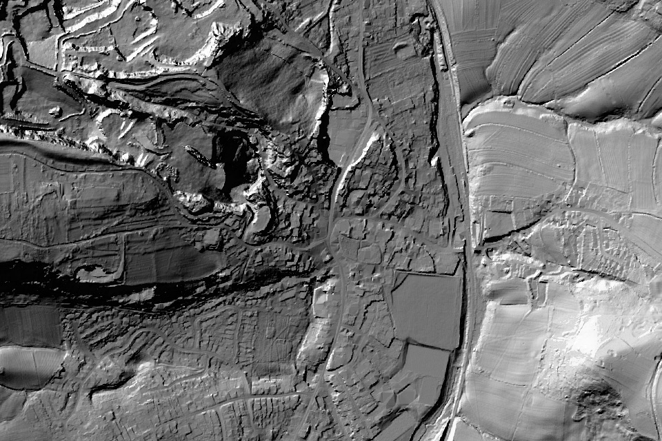 LiDAR: laser scans taken from the air show the shape of the ground with trees and buildings stripped away, so old banks, ditches and boundaries stand out. © Environment Agency copyright and/or database right 2024. All rights reserved.
A second group comprised Darley, Mestesforde, Wirksworth, Ashbourne and Parwich, with their dependent holdings. Together they rendered £40 of pure silver in 1086. This is a group payment, not an individual valuation for Wirksworth or Parwich. See the VCH account on page 331.
The preceding page records a priest, a church and three lead works at Wirksworth. Ashbourne is described as waste but nevertheless rendering 20 shillings; the same entry records the priest’s holding and its working ploughs. Such qualifications show why “waste” cannot automatically be expanded into a claim that every part of an estate was empty.
Contrasting values at Repton and Weston
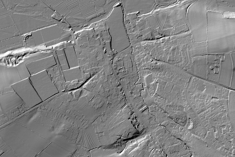 LiDAR: laser scans taken from the air show the shape of the ground with trees and buildings stripped away, so old banks, ditches and boundaries stand out. © Environment Agency copyright and/or database right 2024. All rights reserved.
The Repton and Milton entry names Earl Algar as the earlier holder and the king as the holder in 1086. It records 37 villagers, three smallholders, two mills, a church and two priests. Its value fell from £15 to £8.
At Weston-on-Trent, another estate formerly held by Algar, the recorded value rose from £8 to £16. Its mill rendered 19s 4d and its ferry 13s 4d. The Weston entry provides evidence of these income sources, but does not say that they caused the increase. The comparison demonstrates that estates under the same recorded lord could follow different economic trajectories.
Mickleover and the sites of two mills
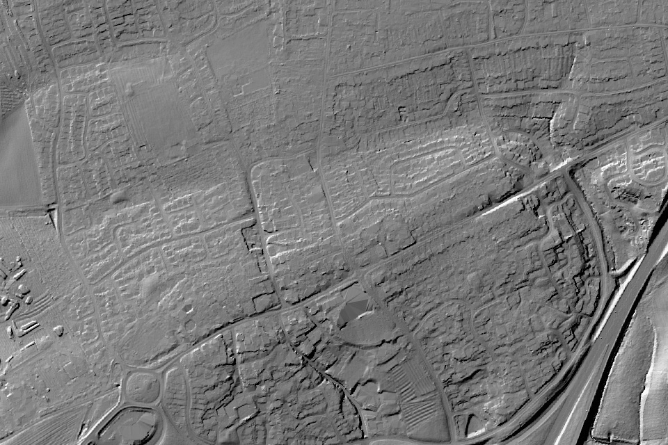 LiDAR: laser scans taken from the air show the shape of the ground with trees and buildings stripped away, so old banks, ditches and boundaries stand out. © Environment Agency copyright and/or database right 2024. All rights reserved.
The estate entered as Ufre, identified in VCH as Mickleover, had belonged to King Edward and was held by Burton Abbey in 1086. Its berewicks included Littleover, Findern and Potlock. The value fell from £25 to £10, a decline of 60%.
Its Domesday entry in the VCH translation records two mill sites, alongside 73 acres of meadow and working plough teams. The reference establishes mill sites rather than two operating mills. It does not date their disuse or identify its cause.
Duffield and a change in lordship
 Beep boop beep / CC BY-SA 4.0 / Wikimedia Commons
At Duffield, the earlier holder was Siward; the estate appears in Henry de Ferrers’s lands in 1086. Its value fell from £9 to £7. The entry records two mills and a working agricultural community, while Holbrook, Milford and Makeney are described as waste among its dependent holdings. See the start of the entry on VCH page 342 and its continuation on page 343.
The entry provides evidence for a change in lordship and differences within the estate. Repeated occurrences of the name Siward elsewhere require further identification work before they can be assembled into a single person’s biography.
Scropton and a disputed claim
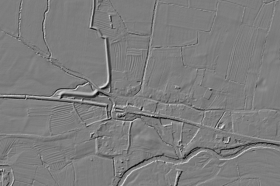 LiDAR: laser scans taken from the air show the shape of the ground with trees and buildings stripped away, so old banks, ditches and boundaries stand out. © Environment Agency copyright and/or database right 2024. All rights reserved.
Scropton appears among Henry de Ferrers’s lands, with Tochi named as the earlier holder. Its value increased from £8 to £10. The entry lists 32 villagers, 26 smallholders, a church, a mill and the site of another mill.
The VCH translation on page 338 also records Geoffrey Alselin’s claim to the estate. This is evidence of a disputed claim at the survey date. It does not record the eventual decision or justify describing the land as having passed by inheritance.
Sudbury and the mill rendering a hundred eels
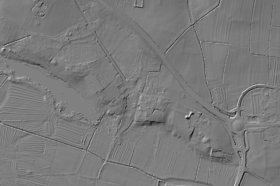 LiDAR: laser scans taken from the air show the shape of the ground with trees and buildings stripped away, so old banks, ditches and boundaries stand out. © Environment Agency copyright and/or database right 2024. All rights reserved.
One Sudbury holding had belonged to Godric, Ulvric and Elmer. By 1086, Alcher held it under Henry de Ferrers. It had 14 villagers and four smallholders with three ploughs, plus a priest and a church.
The Sudbury entry on page 339 records a mill rendering six shillings and a hundred eels. Its value fell from 60 shillings to 20. The eels were a payment in kind attached to the mill, not a count of all fish caught locally. The entry also records 22 acres of meadow and a little underwood; it does not assign 22 acres to each.
Hartington and land described as waste
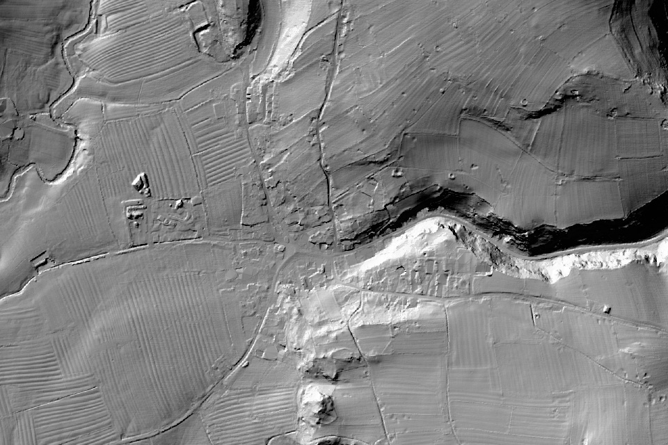 LiDAR: laser scans taken from the air show the shape of the ground with trees and buildings stripped away, so old banks, ditches and boundaries stand out. © Environment Agency copyright and/or database right 2024. All rights reserved.
At Hartington, Godwin and Ligulf had held two carucates assessed to the geld. In Henry de Ferrers’s chapter, the holding is described as waste, with 16 acres of meadow and underwood. Its earlier value was 40 shillings; this entry supplies no corresponding 1086 valuation.
Nearby entries for Salham and for Pilsbury with Ludwell also describe waste. The VCH translation on page 337 preserves those distinctions. An omitted valuation is not a recorded zero, and the entry alone does not establish the fate of every inhabitant.
The Hull Domesday Project’s discussion of waste explains its association with devastation and the alternative interpretations historians have debated. Any account of a particular manor should distinguish the survey’s wording from an explanation reconstructed from other evidence.
Finding the record for your own settlement
Begin with the Derbyshire settlement directory, then identify the holding, its dependent holdings and its source reference. A modern village name may cover several entries, while a figure attached to a large estate may include land beyond the village itself.
Aubrey’s guide to reading a Domesday entry for your village introduces the main fields. For the historical evidence, compare the translation with the original folio and consult the relevant county history. Treat recorded names as a starting point for research rather than proof of a continuous family line or modern property boundary.
Researching a location beyond Domesday
Domesday supplies an early account of landholding, but later records are needed to trace a location through subsequent centuries. Aubrey brings Domesday material together with historical maps, archaeological records and other available evidence. Explore a sample location to see how those sources can be presented together.
Every location has a story. Aubrey finds it.
Archival sources
Original record: The National Archives, Great Domesday Book, E 31/2/1. The Derbyshire county survey begins at folio 272. See the National Archives collection introduction and its research guide linked above.
Published translation consulted: William Page, ed., The Victoria History of the County of Derby, volume I (1905), “Text of the Derbyshire Domesday”, particularly pp. 330 to 334, 337 to 339 and 342 to 343. Page links above lead to the digitised edition. VCH is a published edition and interpretation of the medieval record, not the original manuscript. The Institute of Historical Research publication guide identifies the volume and its contents.