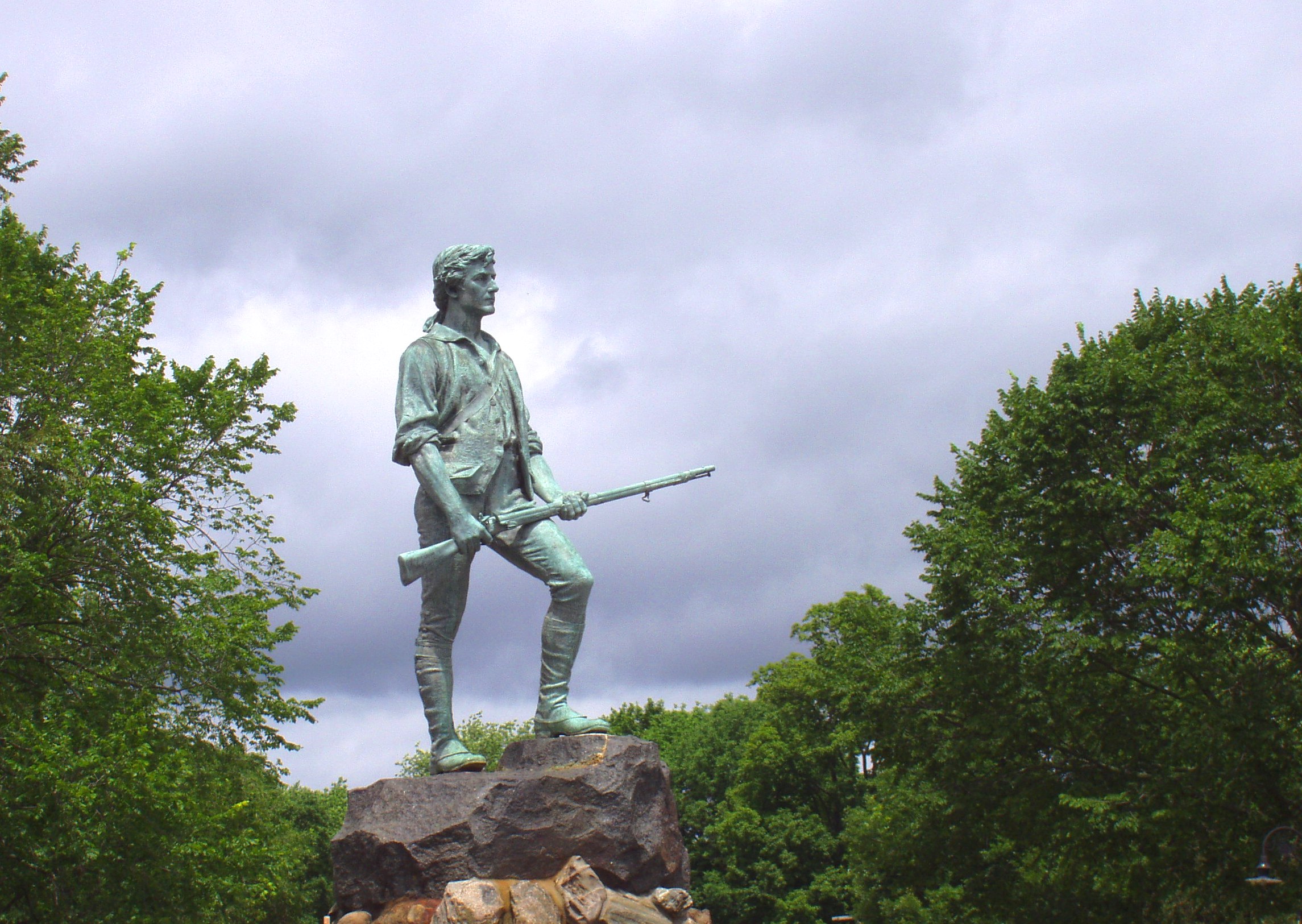
History & Significance
Lexington is a town in Middlesex County, Massachusetts, about twelve miles northwest of Boston on the road to Concord. It was settled in the 1640s as a farming community on land that had been Nipmuc and Massachusetts tribal territory before the catastrophic epidemics of 1616 to 1619 depopulated much of coastal New England. The town received its own precinct in 1691 and its full incorporation as a town in 1713, and for the sixty years that followed it was a quiet agricultural community of farmers and tradespeople, indistinguishable from dozens of others in the Massachusetts Bay Colony.
On the night of April 18, 1775, a force of approximately 700 British regulars marched out of Boston under Lieutenant Colonel Francis Smith with orders to seize a colonial arms cache at Concord. Paul Revere, William Dawes, and Samuel Prescott rode ahead to warn the countryside. By the time the British column reached Lexington at dawn on April 19, Captain John Parker had assembled seventy-seven minutemen on the town common.
What happened next is disputed in its details but clear in its consequences. Someone fired a shot, or shots, and within minutes eight colonists were dead and ten wounded. The British column reformed and marched on to Concord. On their return march that afternoon, Massachusetts militia attacked the column repeatedly from behind stone walls and trees, inflicting serious casualties all the way back to Boston. The battles of Lexington and Concord ended any possibility of a peaceful resolution of the colonial crisis.
The town common where Parker's men stood has been preserved and is today the oldest American battlefield still in approximately its original condition. The deed history of the surrounding parcels runs from the present back through the Middlesex County registry to the original Massachusetts Bay Colony grants, a chain of title that predates American independence by more than a century.
The minutemen and the morning of April 19th
The minutemen who assembled on Lexington Green before dawn on April 19 were not professional soldiers. They were farmers, tradesmen, and craftsmen, men who had agreed to be ready to respond to a military emergency on a minute's notice as part of the colony's local defense system. Captain John Parker, who commanded the Lexington company, was himself a farmer and a veteran of the French and Indian War. Many of the men behind him were his relatives.
Parker's reported orders to his men have become among the most quoted sentences in American history: "Stand your ground. Don't fire unless fired upon, but if they mean to have a war, let it begin here." Whether he said exactly those words is not documented in any contemporary source, but the sentiment they express was consistent with Parker's position: he was not there to start a fight, but he was not going to run from one either.
The British column arrived, and Major John Pitcairn of the Royal Marines ordered the colonists to disperse. Some began to move. The shot came from somewhere, and within seconds both sides were firing. Eight minutemen died on the green: Jonas Parker, John Brown, Caleb Harrington, Jonathan Harrington Jr., Isaac Muzzy, Robert Munroe, Samuel Hadley, and Jedidiah Munroe. Ten more were wounded. One British soldier was slightly wounded. The column marched on.
The return march and what it cost the British
The British column reached Concord, found most of the arms cache already moved or hidden, and began to withdraw. At the North Bridge in Concord, a larger force of Massachusetts militia fired on the British rearguard and the British withdrew more quickly than intended. The return march to Boston was a running fight over sixteen miles of road.
Massachusetts militia companies had assembled from towns across the county and positioned themselves along the road back to Boston. From behind stone walls, houses, barns, and hillsides they fired on the moving column, inflicting casualties at every mile. The disciplined British regulars who had seemed invincible that morning were shaken and bloodied by the time they reached Lexington for the second time. Reinforcements sent from Boston under Lord Percy arrived just in time to prevent the column from being cut off entirely.
By the time the British force reached the safety of Charlestown that evening, 73 of their number were dead, 174 wounded, and 26 missing. Colonial casualties were lower: 49 dead, 39 wounded, 5 missing. The news spread through the colonies overnight. Within days the Massachusetts countryside was in arms and Boston was besieged. The war that John Parker had anticipated on Lexington Green that morning had begun.
The land, the grants, and the battle monument
The Massachusetts Bay Colony's land system was organized around township grants issued by the General Court, within which individual proprietors received shares based on their status and investment in the settlement. Lexington's original settlers received their land under the Cambridge proprietors' share system, and the Middlesex County Registry of Deeds preserves records of the subsequent subdivision and transfer of those original parcels from the 1640s forward.
The Lexington town common, known as the Battle Green, was set aside as common land in the original town layout and has remained public land ever since. The original proprietors' records, the colonial deed books, and the Massachusetts land records provide an unusually complete documentation of land ownership in the town from the earliest settlement. Many of the farms whose owners fought on April 19 can be traced through these records to specific parcels and their subsequent history.
The Lexington Monument on the Battle Green, a granite obelisk erected in 1799, is one of the earliest American monuments to a Revolutionary War engagement. It stands above the vault where the eight men killed on April 19 are buried. The inscription records their names and the date. The monument, the green, and the surrounding historic district are among the best-documented Revolutionary War sites in New England, with a paper trail in land records, probate records, and town minutes that stretches from the present back to the decade before the battle itself.