We believe every place has a story worth telling.
Aubrey Research was built for anyone who has ever stood somewhere and wondered what happened here. The Civil War researcher tracing a regiment, the genealogist chasing a family line, the person who just moved into an old house. We bring the deep record of a place together and tell its story properly, from the ground up.
The engine is named after John Aubrey, born in Wiltshire, England in 1626. He was an antiquary who spent his life uncovering hidden history, at a time when almost no one was doing it. He surveyed Stonehenge and Avebury, cross-referenced land records, and documented forgotten settlements across the country.
He is regarded as one of the founding fathers of archaeology and local history. We carry on his work: to find what is hidden, tell the story of a place honestly, and make it available to anyone who wants to know. What took him a lifetime, Aubrey now does for any location, in minutes.
The Aubrey Holes at Stonehenge are named after him. He surveyed the monument in the 1660s and found 56 chalk pits that had been hidden for 4,500 years.
Centuries of American history, mapped for your location.
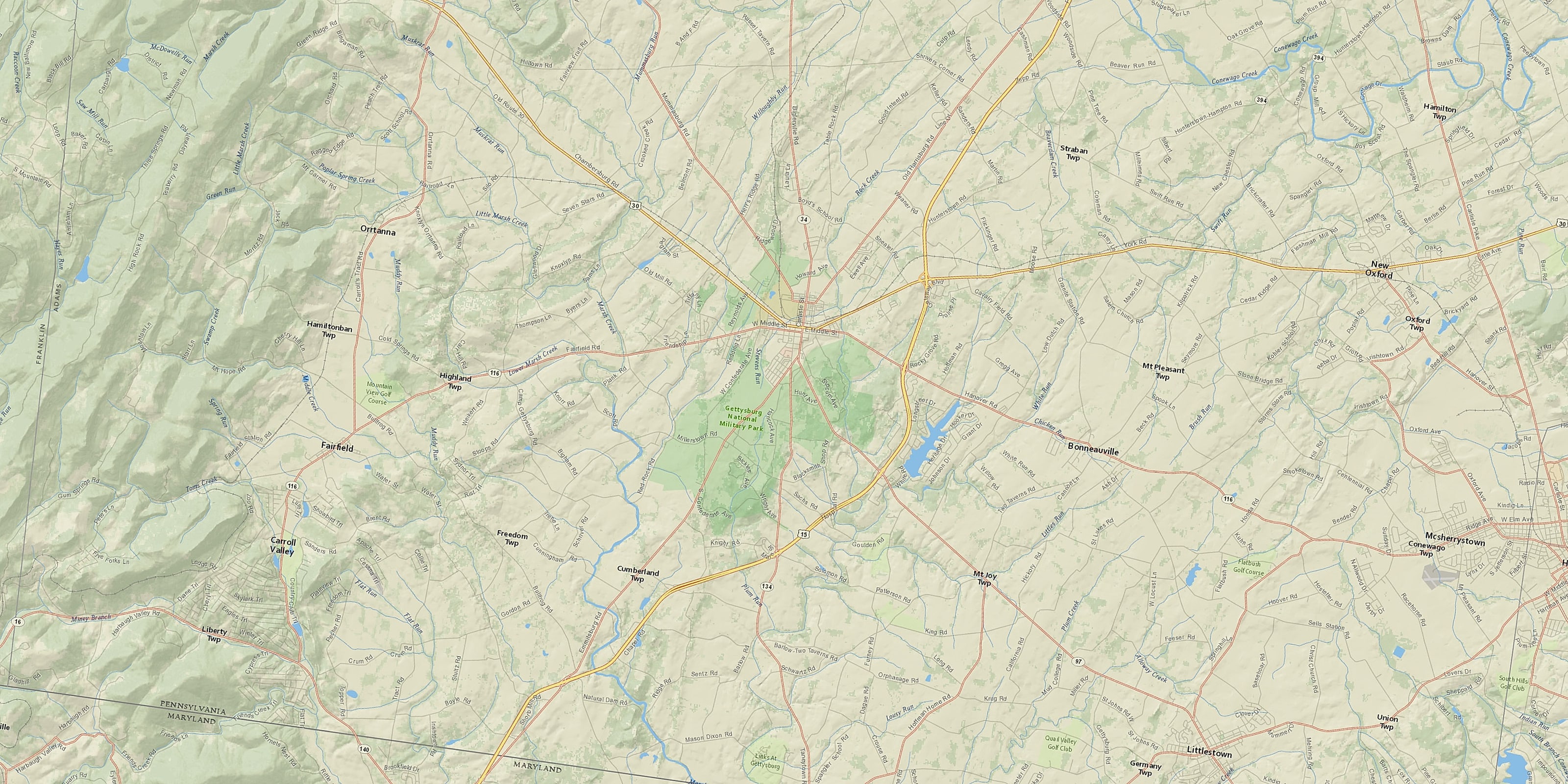
Every report opens on a fully interactive map, with everything Aubrey has found plotted where it happened. Click any marker to explore it.
Map shown: a real Aubrey report for a US location.
Every battle, mapped where it happened.
From the first colonial skirmishes to the great campaigns of the Civil War, Aubrey plots every recorded engagement near your location and tells you who fought, when, and what it changed.
Map shown: a real Aubrey report for a US location.
Everything a full the United States report reveals
Pick any location and Aubrey pulls together 18 strands of its history, each drawn from the record:
Every location is different. Not every section appears for every place, only what the historical record actually holds turns up in a report.
Sixteen ways into your location's past.
Beyond the map, every report holds up to sixteen deep-dive sections, each drawing on different records and different centuries. Which appear depends on the location and what the record holds.
Every location across the country.
All fifty states, from the oldest colonial towns to the newest territories. Each region keeps its own records, and Aubrey reads the ones that belong to your place.
The oldest colonial settlements, the Revolutionary War, and the mills and cities of early American industry.
Colonial and antebellum history, the heart of the Civil War, Reconstruction, and deep Native American roots.
Federal land patents and westward settlement, the great river systems, and the treaties that redrew Native nations.
Territorial history, mining and the railroads, and the Indigenous lands that came before them.
Discover the history of your place.
Start with a real report, or research your own location in minutes.