History & Significance
Perryville is a small town in the rolling limestone country of Boyle County, Kentucky, sitting above Chapline Hill and the Chapline's Fork of the Chaplin River. In the fall of 1862 the region was in the grip of a severe drought. The streams had dried to trickles, springs had failed, and both armies converging on Perryville were as desperate for water as they were for tactical advantage. The collision that followed was not fully planned by either commander.
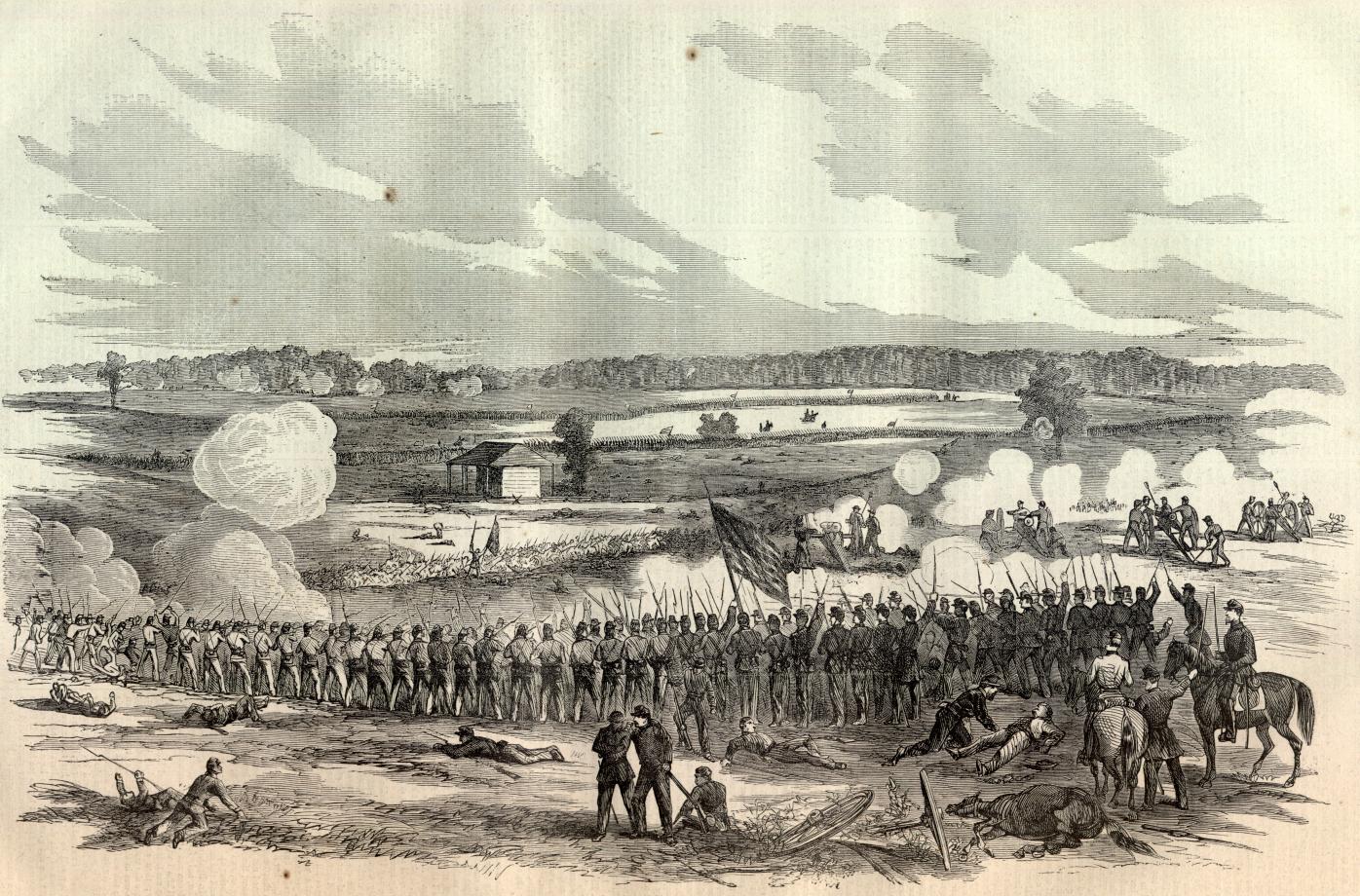
The Battle of Perryville on October 8, 1862, was the largest battle fought in Kentucky during the Civil War and ended the Confederate Army of the Mississippi's attempt to hold the state under Confederate control. General Braxton Bragg's Confederate army had invaded Kentucky in August 1862, hoping to rally Confederate sympathizers and draw Union forces out of Tennessee. The campaign had not gone as planned. Kentucky declined to rise, the hoped-for recruits had not materialized, and Bragg's army was now competing with a Union force under General Don Carlos Buell for control of the limited water supplies in the dry Chaplin River valley.
The battle was decided by early afternoon, when Confederate forces under General Leonidas Polk struck a Union corps that had not been positioned for battle. The fighting was intense and the Union left was driven back significantly before Union reserves stabilized the line. That evening, Bragg learned the full size of Buell's force and chose to withdraw. The Confederate retreat from Kentucky was permanent. The state remained in the Union for the rest of the war, though irregular Confederate forces raided it repeatedly.
Boyle County had been organized in 1842, carved from Lincoln and Mercer counties and named for a Kentucky judge. The town of Perryville received its charter in the same era, and its land records reflect a Kentucky property system derived from Virginia's land grant tradition, a complex mix of overlapping warrants, surveys, and entries that created ownership disputes that Kentucky courts were still sorting out decades later.
The acoustic shadow and the battle that nearly missed its commander
The Battle of Perryville is remembered for one of the strangest documented phenomena in Civil War history: an acoustic shadow so complete that General Buell, commanding the Union army from a position only two miles from the fighting, heard nothing. The atmospheric conditions that afternoon created a dead zone in which the sound of one of the largest battles of the western war simply did not carry to the Union commanding general's position.
Buell spent the afternoon unaware that a major battle was in progress. He had authorized a limited reconnaissance in force but had not ordered a general engagement, and the sound of cannon and musketry that could be heard clearly ten miles away could not be heard at his headquarters. He learned that a battle had been fought only when a courier arrived with reports from the field. By then the fighting was largely over.
The phenomenon meant that tens of thousands of Union soldiers who could have reinforced the engaged corps spent the afternoon in camp, hearing nothing. The Union left, which bore the brunt of the Confederate assault, fought what amounted to a separate battle without the army's reserves being committed. The acoustic shadow may have cost the Union an opportunity to destroy Bragg's army completely.
The limestone farms and the water they ran dry
The land around Perryville is karst limestone country, a terrain shaped by the dissolution of bedrock into sinkholes, springs, and shallow streams. In normal years the Chaplin River and its tributaries provide reliable water across the county. The drought of 1862 had reduced those streams to muddy pools and the springs to seeps. Both armies were moving toward the same water sources because there were no others within reach.
The farms that bordered the battlefield were typical of central Kentucky agricultural land in the 1860s: mixed crop and livestock operations, some with enslaved labor, others worked by the owner's family alone. The Widow Bottom farm, the Crawford farm, the Peters house fields: each appears in Boyle County deed records connecting ownership back through the Kentucky land entry system to the original warrants issued under Virginia's colonial authority before Kentucky achieved statehood in 1792.
After the battle, the farms were strewn with dead from both sides, and local families faced the grim labor of burial before the bodies became a sanitary crisis in the October heat. The state of Kentucky, like other border states, did not organize systematic battlefield burials in the way the federal government did for Union soldiers elsewhere. Many of the Confederate dead were buried in mass graves on the farms where they fell, locations that were not always preserved in later property transactions.
Kentucky's divided loyalties and what the battle settled
Kentucky's position in the Civil War was uniquely complicated. The state declared neutrality in April 1861, a position the Lincoln administration tolerated as long as possible to avoid pushing it into the Confederacy. Both sides organized military forces from Kentucky residents, and a rump Confederate legislature in Bowling Green claimed to represent the state's government while the legitimate legislature in Frankfort remained in the Union.
The Confederate invasion of 1862 was partly a military campaign and partly a political gamble. If enough Kentuckians rallied to the Confederate cause, the state might formally join the Confederacy and its resources would be added to the Confederate war effort. The gamble failed: the recruiters who marched with Bragg's army found far fewer volunteers than expected, and the population's reception was cool rather than enthusiastic.
Perryville ended the question. After Bragg's retreat, Confederate forces never again mounted a sustained campaign to hold Kentucky. The state remained in the Union, but its divided loyalties continued to shape its political life long after the war ended. Boyle County sent men to both armies. The same township produced families who fought on opposite sides, and the postwar social order had to accommodate that reality in ways that the states further north and south did not.