About this property
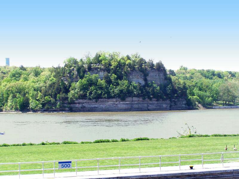
Starved Rock State Park is a state park in the U.S. state of Illinois, characterized by the many canyons within its 2,630 acres (1,064 ha). Located just southeast of the village of Utica, in Deer Park Township, LaSalle County, Illinois, along the south bank of the Illinois River, the park hosts over two million visitors annually, the most for any Illinois state park. A flood from a melting glacier, known as the Kankakee Torrent, which took place approximately 14,000–19,000 years ago led to the topography of the site and its exposed rock canyons. Diverse forest plant life exists in the park and the area supports several wild animal species. Of particular interest has been sport fishing species. Before European contact, the area was home to Native Americans, particularly the Kaskaskia who lived in the Grand Village of the Illinois across the river to the north. Louis Jolliet and Jacques Marquette were the first Europeans recorded as exploring the region, and by 1683, the French had established Fort St. Louis on the large sandstone butte overlooking the river, they called Le Rocher (the Rock). Later after the French had moved on, according to a local legend, a group of Native Americans of the Illinois Confederation (also called Illiniwek or Illini) pursued by the Ottawa and Potawatomi fled to the butte in the late 18th century. In the legend, around 1769 the Ottawa and Potawatomi besieged the butte until all of the Illiniwek had starved, and the butte became known as "Starved Rock". In the late 19th century, parkland around 'Starved Rock' was developed as a vacation resort. The resort was acquired by the State of Illinois in 1911 for a state park, which it remains today. Facilities in the park were built by the Civilian Conservation Corps in the 1930s, which have also gained historic designation. The Rock was designated a National Historic Landmark in 1960. The park region has been the subject of several archeological studies concerning both native and European settlements, and various other archeological sites associated with the park were added to the National Register of Historic Places in 1998.
Location
Categories
Property data from the National Register of Historic Places, National Park Service (public domain).
Description adapted from Wikipedia under the Creative Commons Attribution-ShareAlike 4.0 International License.
Everything a full report reveals about Starved Rock Lodge and Cabins
This page lists Starved Rock Lodge and Cabins. A full Aubrey report for an address near it pulls together this listing alongside battlefield records, land patents, and every other historical record within a chosen radius:
Every location is different. Not every section appears for every place, only what the historical record actually holds turns up in a report.
Nearby Battles
Questions about this property
When was Starved Rock Lodge and Cabins listed on the National Register?
Starved Rock Lodge and Cabins was listed on the National Register of Historic Places on May 7, 1985.
What type of historic resource is Starved Rock Lodge and Cabins?
Starved Rock Lodge and Cabins is classified as a building in the National Register of Historic Places.
What is the period of significance for Starved Rock Lodge and Cabins?
The period of significance for Starved Rock Lodge and Cabins is recorded as the industrial era.
Can I research the history near Starved Rock Lodge and Cabins?
Yes. Aubrey Research reports search National Register listings, battlefield records, land patents, and other primary historical sources within any radius of a US address. A report for an address near Starved Rock Lodge and Cabins will include this listing and all other historical records in the area.
More in La Salle County
Historic places, battles, and census history across La Salle County.
Explore La SalleCounty ›More historic places in Illinois
Browse all historic places in Illinois.
View Illinoishistoric sites ›Research the history near this site
An Aubrey US report for an address near Starved Rock Lodge and Cabins will include this listing alongside battlefield records and other historical sources within your chosen radius.