About this property
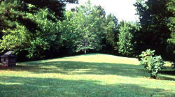
The Boyd Mounds Site (22MD512) is an archaeological site from the Late Woodland and Early Mississippian period located in Madison County, Mississippi near Ridgeland. Many of the mounds were excavated by The National Park Service in 1964. It is located at mile 106.9 on the old Natchez Trace, now the Natchez Trace Parkway. It was added to the NRHP on July 14, 1989 as NRIS number 89000784. The site consists of six burial mounds dating to the Late Woodland and Early Mississippian period. Of the six mounds at the site, Mound 2 is situated next to a parking area off the Natchez Trace Parkway and is accessible to visitors. Mound 2 is 110 feet (34 m) by 60 feet (18 m) and 4 feet (1.2 m) in height. Excavations done by the National Park Service in the early 1960s showed that the mound was initially two mounds that were constructed side by side but were later joined together when a new layer of earth was added to create a single oblong mound. Excavators also found the remains of forty one individuals, and an array of artifacts such as pottery in the mound. Old Natchez Trace segments listed on the National Register of Historic Places. Media related to Boyd Mounds Site at Wikimedia Commons
Location
Categories
Property data from the National Register of Historic Places, National Park Service (public domain).
Description adapted from Wikipedia under the Creative Commons Attribution-ShareAlike 4.0 International License.
Everything a full report reveals about Boyd Mounds Site (22MD512)
This page lists Boyd Mounds Site (22MD512). A full Aubrey report for an address near it pulls together this listing alongside battlefield records, land patents, and every other historical record within a chosen radius:
Every location is different. Not every section appears for every place, only what the historical record actually holds turns up in a report.
Questions about this property
When was Boyd Mounds Site (22MD512) listed on the National Register?
Boyd Mounds Site (22MD512) was listed on the National Register of Historic Places on July 13, 1989.
What type of historic resource is Boyd Mounds Site (22MD512)?
Boyd Mounds Site (22MD512) is classified as a site in the National Register of Historic Places.
What is the period of significance for Boyd Mounds Site (22MD512)?
The period of significance for Boyd Mounds Site (22MD512) is recorded as the modern era, specifically around 1964.
Can I research the history near Boyd Mounds Site (22MD512)?
Yes. Aubrey Research reports search National Register listings, battlefield records, land patents, and other primary historical sources within any radius of a US address. A report for an address near Boyd Mounds Site (22MD512) will include this listing and all other historical records in the area.
More in Madison County
Historic places, battles, and census history across Madison County.
Explore MadisonCounty ›More historic places in Mississippi
Browse all historic places in Mississippi.
View Mississippihistoric sites ›Mississippi history
Colonial settlement, territorial period, and statehood narrative.
Mississippihistory ›Research the history near this site
An Aubrey US report for an address near Boyd Mounds Site (22MD512) will include this listing alongside battlefield records and other historical sources within your chosen radius.