About this property
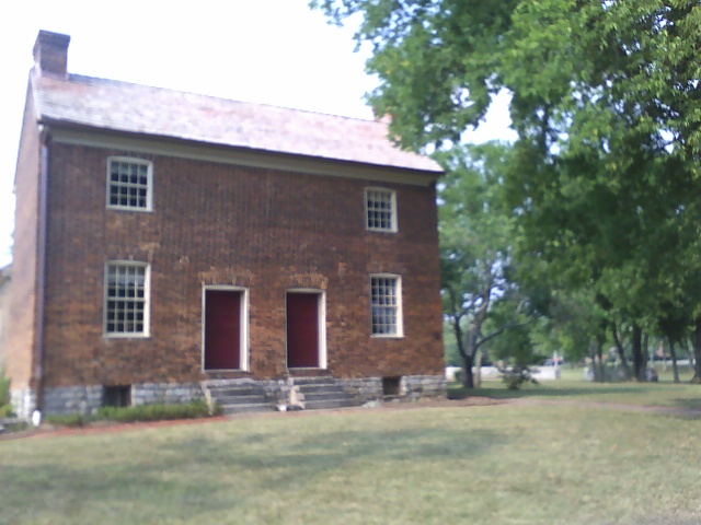
The Bowen–Campbell House, also known as the Bowen Plantation House, is a two-story, Federal style, brick house located in Goodlettsville, Sumner County, Tennessee. The house was built from 1787 to 1788 by Captain William Bowen, a veteran of Lord Dunmore's War of 1774, the French and Indian War of 1754 to 1763, and the American Revolutionary War who brought his family to the area in 1785. His son, William Russell Bowen, later lived in the house. His grandson, Brigadier General William Bowen Campbell who served as Governor of Tennessee from 1851 to 1853 and U.S. Congressman from Tennessee from 1837 to 1843, was born in the house in 1807. It is the oldest brick house in Middle Tennessee. The brick masons were imported from Lexington, Kentucky. The original plantation area around the house is now the home of Moss-Wright Park. The Bowen–Campbell House Association as well as the Tennessee Historical Commission, restored the house in 1976. In 1977, the structure was placed on the National Register of Historic Places. Archeologists found the family cemetery on the property in 1995 and restored it in 1996. It is open for tours as part of Historic Mansker's Station.
Location
Categories
Property data from the National Register of Historic Places, National Park Service (public domain).
Description adapted from Wikipedia under the Creative Commons Attribution-ShareAlike 4.0 International License.
Everything a full report reveals about Bowen-Campbell House
This page lists Bowen-Campbell House. A full Aubrey report for an address near it pulls together this listing alongside battlefield records, land patents, and every other historical record within a chosen radius:
Every location is different. Not every section appears for every place, only what the historical record actually holds turns up in a report.
Questions about this property
When was Bowen-Campbell House listed on the National Register?
Bowen-Campbell House was listed on the National Register of Historic Places on July 24, 1977.
What type of historic resource is Bowen-Campbell House?
Bowen-Campbell House is classified as a building in the National Register of Historic Places.
What is the period of significance for Bowen-Campbell House?
The period of significance for Bowen-Campbell House is recorded as the early_republic era.
Can I research the history near Bowen-Campbell House?
Yes. Aubrey Research reports search National Register listings, battlefield records, land patents, and other primary historical sources within any radius of a US address. A report for an address near Bowen-Campbell House will include this listing and all other historical records in the area.
More in Sumner County
Historic places, battles, and census history across Sumner County.
Explore SumnerCounty ›More historic places in Tennessee
Browse all historic places in Tennessee.
View Tennesseehistoric sites ›Tennessee history
Colonial settlement, territorial period, and statehood narrative.
Tennesseehistory ›Research the history near this site
An Aubrey US report for an address near Bowen-Campbell House will include this listing alongside battlefield records and other historical sources within your chosen radius.