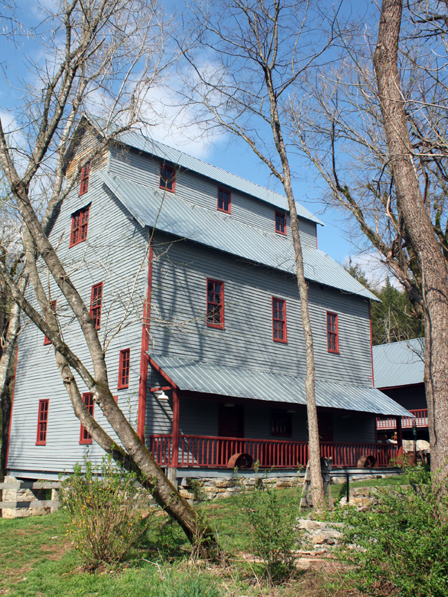
About this property
The Readyville Mill was a historic mill located in Readyville, Tennessee, located in Cannon County, near the border of Rutherford County. The original water-powered grist mill was constructed by the community founder Colonel Charles Ready in 1812. Ownership of the mill remained in the family until it burned down during the American Civil War for unknown reasons. Robert Carter rebuilt the mill in the 1870s and acquired full ownership of it in 1884. After being engaged in several different trades for several different owners, the mill closed in 1978. In 2009, the mill was reopened after a three-year renovation as a privately owned restaurant. The grounds consisted of five newly restored buildings: The Grist Mill, Granary, Icehouse, Miller's Cabin, and Smokehouse. In February 2023, the restaurant and mill were once again closed after several recent changes of management and ownership. The mill was added to the National Register of Historic Places on June 12, 1973 and featured on an episode of Tennessee Crossroads in 2015. The mill building and grounds were destroyed by an EF2 tornado around 1:55 a.m. on April 1, 2023. The debris was cleared in March 2024 so that construction could begin on a new general store in the former location.
Location
Property data from the National Register of Historic Places, National Park Service (public domain).
Description adapted from Wikipedia under the Creative Commons Attribution-ShareAlike 4.0 International License.
Everything a full report reveals about Readyville Mill
This page lists Readyville Mill. A full Aubrey report for an address near it pulls together this listing alongside battlefield records, land patents, and every other historical record within a chosen radius:
Every location is different. Not every section appears for every place, only what the historical record actually holds turns up in a report.
Nearby Battles
Questions about this property
When was Readyville Mill listed on the National Register?
Readyville Mill was listed on the National Register of Historic Places on July 2, 1973.
What type of historic resource is Readyville Mill?
Readyville Mill is classified as a building in the National Register of Historic Places.
What is the period of significance for Readyville Mill?
The period of significance for Readyville Mill is recorded as the early_republic era, specifically around 1812.
Can I research the history near Readyville Mill?
Yes. Aubrey Research reports search National Register listings, battlefield records, land patents, and other primary historical sources within any radius of a US address. A report for an address near Readyville Mill will include this listing and all other historical records in the area.
More historic places in Tennessee
Browse all historic places in Tennessee.
View Tennesseehistoric sites ›Tennessee history
Colonial settlement, territorial period, and statehood narrative.
Tennesseehistory ›Research the history near this site
An Aubrey US report for an address near Readyville Mill will include this listing alongside battlefield records and other historical sources within your chosen radius.