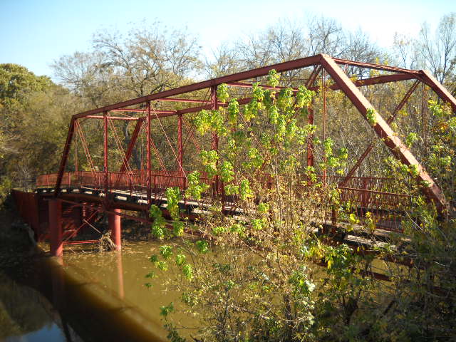
About this property
Old Alton Bridge, also known as Goatman's Bridge, is a historic iron truss bridge connecting the Texas cities of Denton and Copper Canyon. Built in 1884 by the King Iron Bridge Manufacturing Company, it originally carried horses and later automobiles over Hickory Creek at a location that once was a popular ford for crossing cattle. The bridge takes its name from the abandoned community of Alton, which between 1850 and 1856 was the seat of Denton County. This bridge is the subject of several ghostlore stories featuring a vengeful ghost. The heavily traveled Old Alton Bridge remained in constant use until 2001 when vehicle traffic was moved to an adjacent concrete-and-steel bridge. Prior to the new bridge, it was necessary for motorists to signal with a car horn before crossing the single-lane span. The new bridge straightened out a sharp curve on both sides of the creek and provided additional travel lanes. With vehicle traffic removed, the bridge became an important link connecting the Elm Fork and Pilot Knoll Hiking and Equestrian Trails. Today, it is a popular location for nature enthusiasts and photographers. Old Alton Bridge was included in the National Register of Historic Places on July 8, 1988.
Location
Categories
Property data from the National Register of Historic Places, National Park Service (public domain).
Description adapted from Wikipedia under the Creative Commons Attribution-ShareAlike 4.0 International License.
Everything a full report reveals about Old Alton Bridge
This page lists Old Alton Bridge. A full Aubrey report for an address near it pulls together this listing alongside battlefield records, land patents, and every other historical record within a chosen radius:
Every location is different. Not every section appears for every place, only what the historical record actually holds turns up in a report.
Questions about this property
When was Old Alton Bridge listed on the National Register?
Old Alton Bridge was listed on the National Register of Historic Places on July 7, 1988.
What type of historic resource is Old Alton Bridge?
Old Alton Bridge is classified as a structure in the National Register of Historic Places.
What is the period of significance for Old Alton Bridge?
The period of significance for Old Alton Bridge is recorded as the early_republic era, specifically around 1850.
Can I research the history near Old Alton Bridge?
Yes. Aubrey Research reports search National Register listings, battlefield records, land patents, and other primary historical sources within any radius of a US address. A report for an address near Old Alton Bridge will include this listing and all other historical records in the area.
More in Denton County
Historic places, battles, and census history across Denton County.
Explore DentonCounty ›Research the history near this site
An Aubrey US report for an address near Old Alton Bridge will include this listing alongside battlefield records and other historical sources within your chosen radius.