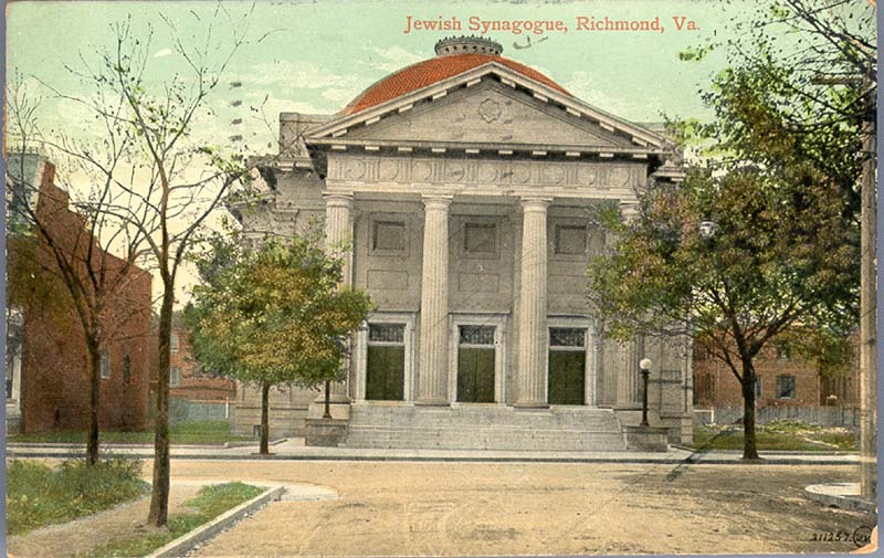
About this property
The West Franklin Street Historic District is a national historic district located at Richmond, Virginia. It is located along the northern boundary of the Fan district. The district encompasses 71 contributing buildings built between about 1870 and the 1920. It was originally developed as a primarily residential district with buildings in a variety of popular late-19th and early-20th century architectural styles including Greek Revival, Romanesque, Georgian Revival, Queen Anne, and Italianate. Many of the dwellings have been converted to commercial use. In addition, the district's private houses have been converted into multi-family housing and departmental offices for Virginia Commonwealth University. Notable buildings include Franklin Terrace, the Ritter-Hickock House, First Independent Church, Founder's Hall, the Raleigh Building, The Greyston Apartments, Gresham Court Apartments, and the Beth Ahabah Congregation Hall and Synagogue. It was added to the National Register of Historic Places in 1972, with a boundary increase in 2009.
Location
Categories
Property data from the National Register of Historic Places, National Park Service (public domain).
Description adapted from Wikipedia under the Creative Commons Attribution-ShareAlike 4.0 International License.
Everything a full report reveals about West Franklin Street Historic District (Boundary Increase)
This page lists West Franklin Street Historic District (Boundary Increase). A full Aubrey report for an address near it pulls together this listing alongside battlefield records, land patents, and every other historical record within a chosen radius:
Every location is different. Not every section appears for every place, only what the historical record actually holds turns up in a report.
Questions about this property
When was West Franklin Street Historic District (Boundary Increase) listed on the National Register?
West Franklin Street Historic District (Boundary Increase) was listed on the National Register of Historic Places on September 15, 2009.
What type of historic resource is West Franklin Street Historic District (Boundary Increase)?
West Franklin Street Historic District (Boundary Increase) is classified as a district in the National Register of Historic Places.
What is the period of significance for West Franklin Street Historic District (Boundary Increase)?
The period of significance for West Franklin Street Historic District (Boundary Increase) is recorded as the early_republic era.
Can I research the history near West Franklin Street Historic District (Boundary Increase)?
Yes. Aubrey Research reports search National Register listings, battlefield records, land patents, and other primary historical sources within any radius of a US address. A report for an address near West Franklin Street Historic District (Boundary Increase) will include this listing and all other historical records in the area.
More in Richmond County
Historic places, battles, and census history across Richmond County.
Explore RichmondCounty ›More historic places in Virginia
Browse all historic places in Virginia.
View Virginiahistoric sites ›Research the history near this site
An Aubrey US report for an address near West Franklin Street Historic District (Boundary Increase) will include this listing alongside battlefield records and other historical sources within your chosen radius.