About this property
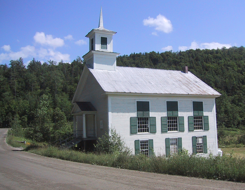
The Kents Corner Historic District encompasses a well-preserved 19th-century crossroads hamlet in Calais, Vermont. Centered on the junction of Kent Hill Road, Old West Church Road, and Robinson Cemetery Road, it developed as a stagecoach stop with a small industrial presence. It was listed on the National Register of Historic Places in 1973, and substantially enlarged in 2006. The Kents Corner area of Calais was settled in the late 1780s by members of the Wheelock family, and the area that is now called Kents Corner was where Remember Kent built his first log cabin (now incorporated into a nearby house) in 1797. The main roads (Kent Hill Road running east–west and Old West Church Road/Robinson Cemetery Road running north–south) were laid out in the early 20th century, crossing on Kent's property. The north–south road became part of a stagecoach route between Montpelier and Montreal, and the Kents added a tavern and general store to their holdings, the former surviving as a fine Federal period brick house that has most recently seen use as a local history museum. The area has historically remained rural and agricultural, although there have been several small-scale industrial uses, including mills and a small brickyard. When first listed on the National Register in 1973, the district consisted of the properties within 0.25 miles (0.40 km) of the road junction, extended southward on Old West Church Road to include the Old West Church. Its resources were also incompletely described. In 2006, following a resurvey of the area, the district was substantially enlarged, extending eastward to Pekins Brook Road, westward about halfway to Maple Corner, and southward beyond the Old West Church to Bliss and Fowler Roads. In addition to the predominantly Greek Revival architecture found in the area, the expanded district includes industrial archaeological resources, and landscape features such as the Bliss Town Forest. At the eastern end of the district is the former church building that now serves as Calais Town Hall. North of the junction on Robinson Cemetery Road stands a 19th-century sawmill. National Register of Historic Places listings in Washington County, Vermont
Location
Categories
Property data from the National Register of Historic Places, National Park Service (public domain).
Description adapted from Wikipedia under the Creative Commons Attribution-ShareAlike 4.0 International License.
Everything a full report reveals about Kents Corner Historic District
This page lists Kents Corner Historic District. A full Aubrey report for an address near it pulls together this listing alongside battlefield records, land patents, and every other historical record within a chosen radius:
Every location is different. Not every section appears for every place, only what the historical record actually holds turns up in a report.
Questions about this property
When was Kents Corner Historic District listed on the National Register?
Kents Corner Historic District was listed on the National Register of Historic Places on May 7, 1973.
What type of historic resource is Kents Corner Historic District?
Kents Corner Historic District is classified as a district in the National Register of Historic Places.
What is the period of significance for Kents Corner Historic District?
The period of significance for Kents Corner Historic District is recorded as the listed era.
Can I research the history near Kents Corner Historic District?
Yes. Aubrey Research reports search National Register listings, battlefield records, land patents, and other primary historical sources within any radius of a US address. A report for an address near Kents Corner Historic District will include this listing and all other historical records in the area.
More in Washington County
Historic places, battles, and census history across Washington County.
Explore WashingtonCounty ›Research the history near this site
An Aubrey US report for an address near Kents Corner Historic District will include this listing alongside battlefield records and other historical sources within your chosen radius.