About this property
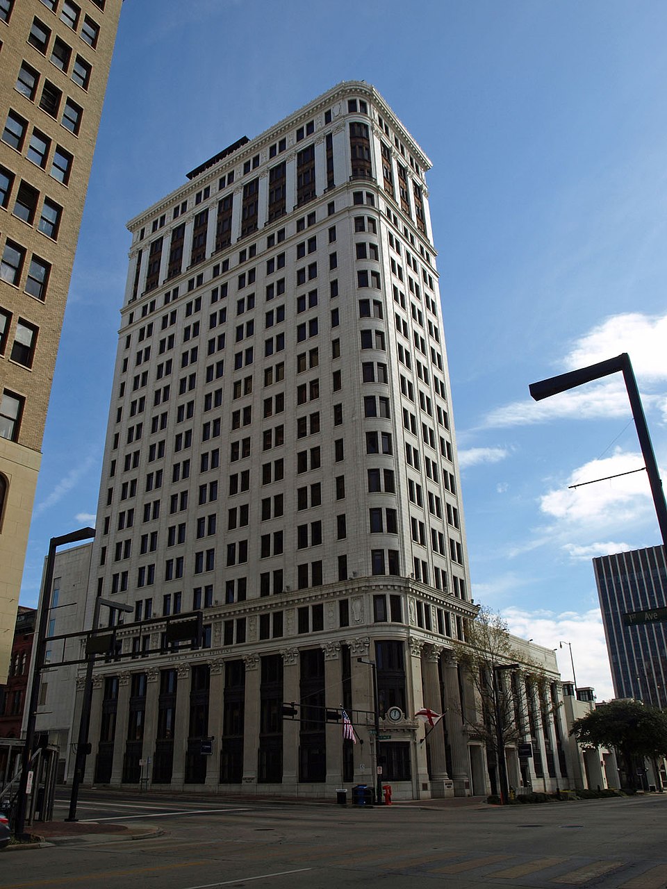
John Hand Building is a mixed-use high rise building in Birmingham, Alabama, US, with a height of 287 feet (87 m). It was the tallest building in the city until surpassed by the City Federal Building in 1913. It comprises 20 floors and was completed in 1912. The lower eight floors are for commercial use and the upper twelve floors are for residential use. In 1983, the building was added to the National Register of Historic Places. From the time of its construction and up until the mid-1990s, the building had been owned and occupied by AmSouth Bancorporation and its predecessors. After AmSouth relocated employees to its other downtown offices and its Riverchase Campus, the building was sold to a group of developers. In 2000, it was renovated at a cost of $20 million. It served as the corporate headquarters of Cadence Bank and its predecessor bank until 2013 when it relocated to the Concord Center. The building now has since served as the corporate headquarters for Shipt, which had its logo on the south-side of the building until 2022, when it was replaced by the logo for Shipt's sister company, Landing.
Location
Categories
Property data from the National Register of Historic Places, National Park Service (public domain).
Description adapted from Wikipedia under the Creative Commons Attribution-ShareAlike 4.0 International License.
Everything a full report reveals about First National-John A. Hand Building
This page lists First National-John A. Hand Building. A full Aubrey report for an address near it pulls together this listing alongside battlefield records, land patents, and every other historical record within a chosen radius:
Every location is different. Not every section appears for every place, only what the historical record actually holds turns up in a report.
Questions about this property
When was First National-John A. Hand Building listed on the National Register?
First National-John A. Hand Building was listed on the National Register of Historic Places on September 28, 1983.
What type of historic resource is First National-John A. Hand Building?
First National-John A. Hand Building is classified as a building in the National Register of Historic Places.
What is the period of significance for First National-John A. Hand Building?
The period of significance for First National-John A. Hand Building is recorded as the industrial era, specifically around 1912.
Can I research the history near First National-John A. Hand Building?
Yes. Aubrey Research reports search National Register listings, battlefield records, land patents, and other primary historical sources within any radius of a US address. A report for an address near First National-John A. Hand Building will include this listing and all other historical records in the area.
More in Jefferson County
Historic places, battles, and census history across Jefferson County.
Explore JeffersonCounty ›Research the history near this site
An Aubrey US report for an address near First National-John A. Hand Building will include this listing alongside battlefield records and other historical sources within your chosen radius.