BattlefieldsBattle of Southwark
Early Medieval

Battle of Southwark

1066
England
Era
Early Medieval
Battle Type
Pitched Battle
Location
England
Status
Unregistered
Forces involved

Duchy of Normandy: 500 cavalry

Outcome
Norman retreat.
The Battle

History & Significance

The Burning of Southwark was a battle fought in Southwark during the Norman Conquest of England in October 1066.

The Norman soldiers of William, Duke of Normandy fought with Anglo-Saxon soldiers in Southwark for control of London Bridge, crossing the River Thames to the English capital London. The Normans defeated the Anglo-Saxons in the battle but withdrew from Southwark due to strong local resistance, setting fire to the town during their retreat to spread terror. Southwark was destroyed and William marched westwards and cut off Anglo-Saxon supply routes to London, which led to the city submitting to his rule.

William, Duke of Normandy, had launched his invasion of the Kingdom of England in late September 1066, declaring his claim to the English throne following the death of the childless Anglo-Saxon King Edward the Confessor, the son of his great-aunt Emma of Normandy. Edward's death in January 1066 saw his brother-in-law Harold Godwinson proclaimed king by the Anglo-Saxon Witenagemot, but still resulted in a violent succession crisis contested by his brother Tostig Godwinson, the King of Norway Harald Hardrada, and Ælfgar, Earl of Mercia's sons Morcar and Ēadwine. Harold had defeated his other opponents by 25 September, leaving William's invasion on 28 September his only remaining threat.

On 14 October, William defeated an English force at the Battle of Hastings and killed Harold, then moved to secure the English capital at London, where Edgar Ætheling had been proclaimed king by the Witenagemot. Expecting little resistance, William sent a small force of cavalry to the strategic town of Southwark to secure the southern end of London Bridge, which provided a crossing of the River Thames and direct access to London. At the time, Southwark was a partially-fortified suburb town of London and formed part of the personal estate of Godwinson's family.

Some of London's population supported William but many resisted the Norman invaders, with the local Anglo-Saxon forces led by Ansgar (or Esegar) the "Staller" (Royal standard bearer) and sheriff of Middlesex. Ansgar had been wounded whilst leading a contingent of Londoners for Harold at the Battle of Hastings, but had returned to the city with a number of other Anglo-Saxon leaders to organise a defence against William. Although Ansgar's wounds were so severe that he was not capable of walking and had to be carried in a litter, he seems to have mustered a force by that season's third raising of the fyrd, and his troops were described as "numerous and formidable". William made an offer to Ansgar that he could retain his estates and position as sheriff and join William's council if he recognised him as king. Ansgar refused to accept the terms and led a number of London citizenry against the Norman force at Southwark: Edwin, Earl of Mercia, Morcar, Earl of Northumbria and Ealdred, Archbishop of York may possibly have been amongst the defenders. The 500 Norman knights defeated the Anglo-Saxon force and reached London Bridge but, shocked at the fierce defence put up by the defenders, they were unable to hold the structure and soon withdrew. The town of Southwark was set ablaze by the Normans as they withdrew to spread terror amongst the inhabitants of London across the river. Almost the entire town was destroyed, including the Southwark mint, which did not recover its former levels of production until the late 1080s.

The ground

The ground they fought on

The site of Battle of Southwark lies on Thames Group, bedrock that formed in the Eocene. The rock here is clay, silt, sand and gravel.

Questions & Answers

Frequently Asked Questions

Unlimited access

Everything a full report reveals about Battle of Southwark

This page covers Battle of Southwark. A full Aubrey report for the area pulls together this battle alongside scheduled monuments and everything else the record holds within a few miles:

Overview
An interactive map of the location with every monument and battle plotted, and a plain-language history built only from what the record holds.
Monuments
The legally protected scheduled monuments around the location, each with its period, type and significance.
Battlefields
The battles and sieges fought on this ground, mapped and set on a timeline of the wider conflict.
Roman Britain
The Roman roads, forts and towns near here, and the Iron Age people who held the land before Rome arrived.
Domesday
The settlement's entry in the 1086 Domesday Book: who held it, what it was worth, and the people who worked the land.
Civil War
The Civil War fighting, garrisons and recorded militaria in this area, woven into the arc of 1642 to 1651.
Geology
The bedrock beneath the site, its age and rock type, reaching back hundreds of millions of years.
LiDAR
Laser-scanned terrain that reveals earthworks hidden under fields and woodland, with likely features flagged.
Local Names
What the street and field names around here actually mean, and the history buried inside them.
Historical Maps
Ordnance Survey maps from the 1800s, layered over the location as it stands today.
Literature
The books, county histories, charters and archives that mention this place, quoted with their sources.
Legal
The protected sites nearby and the metal-detecting, access and treasure laws that apply to this ground.
Spotlight
A deep dive into the most remarkable, lesser-known history of the place, traced back to the record.
Target Zones
For detectorists: the most promising ground to search nearby, ranked by confidence, with what to expect.
Timeline
The whole story of the location told era by era, from prehistory to the present day.
First month just £4.99, then £9.99 a month. Unlimited locations, cancel anytime.

Every location is different. Not every section appears for every place, only what the historical record actually holds turns up in a report.

Start your Battle of Southwark report
Or see a real report first
Protected heritage nearby

Scheduled Monuments near Battle of Southwark

Remains of Winchester Palace, Clink Street and waterfront
Scheduled monument · ~0.2 mi

Remains of Winchester Palace, Clink Street and waterfront is a medieval palace complex located on the south bank of the Thames in Southwark, London. The site was the London residence of the Bishops of Winchester from the twelfth century onwards and served as an important episcopal administrative…

Photograph by Mike Peel (www.mikepeel.net). / CC BY-SA 4.0 / Wikimedia Commons
Fishmongers' Hall
Fishmongers' Hall
Scheduled monument · ~0.3 mi

Fishmongers' Hall is a Grade I listed building located in London Bridge, within the City of London. The present structure dates from 1827-1835 and was designed by architect Henry Roberts following the destruction of the medieval hall in the Great Fire of 1666. The building served as the headquart…

Stephen Richards / CC BY-SA 2.0 / Wikimedia Commons
Watermen's Hall
Watermen's Hall
Scheduled monument · ~0.3 mi

Watermen's Hall is a Grade I listed building located in London, constructed in the seventeenth century as the headquarters of the Company of Watermen and Lightermen. The building, situated on the Upper Thames Street waterfront, dates from 1668 and was designed by Edward Jerman following the Great…

Henryrothery / CC BY-SA 4.0 / Wikimedia Commons
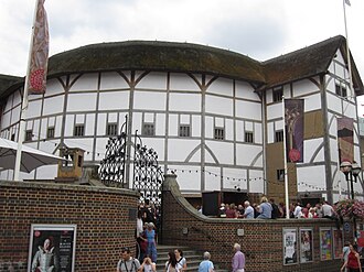
The Globe Theatre
The Globe Theatre
Scheduled monument · ~0.3 mi

I cannot locate reliable scholarly evidence for a monument called "The Globe Theatre" designated as an ancient monument in Surrey with the NHLE reference 1012806. The renowned Globe Theatre was located in Southwark, London (not Surrey), and was a playhouse of the Elizabethan and early Jacobean pe…

Another Believer / CC BY-SA 4.0 / Wikimedia Commons
Roman hypocaust and building on site of Coal Exchange
Scheduled monument · ~0.3 mi

I appreciate your request, but I must acknowledge that I have no reliable scholarly information in my training data about a hypocaust or Roman building at the Coal Exchange site in Middlesex with the specific list entry number 1005546. Rather than provide text that might be inaccurate or invented…

Carla Brain / CC BY-SA 2.0 / Wikimedia Commons
Monument
Monument
Scheduled monument · ~0.3 mi

Monument is a ancient monument in Middlesex, England. The site is registered on the National Heritage List for England under entry 1002065. Without access to detailed scholarly records specific to this particular monument's excavation and dating, I can note that Middlesex contains numerous archae…

Eluveitie / CC BY-SA 3.0 / Wikimedia Commons
Romano-British bath house and medieval remains at 11-15 Borough High Street
Scheduled monument · ~0.1 miles
Roman riverboat, 136m west of Greenwood Theatre
Scheduled monument · ~0.2 miles
Aubrey Research

Explore the landscape around this battlefield

Aubrey generates in-depth historical research for any location in the UK — drawing on Domesday records, scheduled monuments, Victorian OS maps, geological data and archaeological archives to tell the full story of a place.

Research a location near this battlefieldView a sample report
Sources