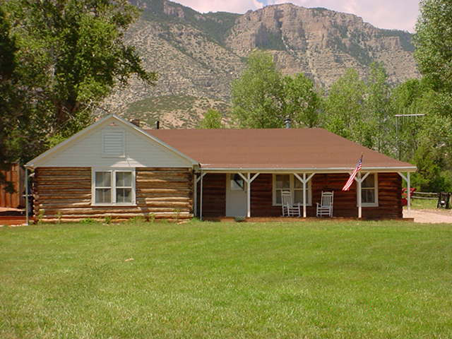
About this property
The Ewing-Snell Ranch was established between 1896 and 1898 by Erastus Ewing in Carbon County, Montana, on Layout Creek between Bighorn Canyon and the Pryor Mountains in a region called Dryhead Country. Ewing took up ranching after failing as a gold miner. Erastus Ewing was born in Tennessee about 1846, arriving in Montana in the 1880s to look for gold. He staked numerous claims, one of which controlled the water rights for Layout Creek. After giving up prospecting, he used the rights to establish his ranch, digging a ditch to his homestead from the creek. Ewing's place was designated a post office in 1898, operating until 1906 as Ewing, Montana before moving to the Caroline Lockhart Ranch. Erastus died in 1904. His son Lee sold the ranch to Clint Hough in 1911, who sold it to Philip Snell in 1918. The shop building operated as the Dryhead School in 1945–1957. Snell's descendants sold the ranch to Newell K. Sorenson in 1964. Sorenson sold 640 acres (260 ha) to the Bureau of Reclamation for the construction of Yellowtail Dam in 1968. The ranch is part of Bighorn Canyon National Recreation Area. The Ewing-Snell Ranch was placed on the National Register of Historic Places on May 12, 1977.
Location
Categories
Property data from the National Register of Historic Places, National Park Service (public domain).
Description adapted from Wikipedia under the Creative Commons Attribution-ShareAlike 4.0 International License.
Everything a full report reveals about Ewing-Snell Ranch
This page lists Ewing-Snell Ranch. A full Aubrey report for an address near it pulls together this listing alongside battlefield records, land patents, and every other historical record within a chosen radius:
Every location is different. Not every section appears for every place, only what the historical record actually holds turns up in a report.
Questions about this property
When was Ewing-Snell Ranch listed on the National Register?
Ewing-Snell Ranch was listed on the National Register of Historic Places on May 11, 1977.
What type of historic resource is Ewing-Snell Ranch?
Ewing-Snell Ranch is classified as a building in the National Register of Historic Places.
What is the period of significance for Ewing-Snell Ranch?
The period of significance for Ewing-Snell Ranch is recorded as the early_republic era, specifically around 1846.
Can I research the history near Ewing-Snell Ranch?
Yes. Aubrey Research reports search National Register listings, battlefield records, land patents, and other primary historical sources within any radius of a US address. A report for an address near Ewing-Snell Ranch will include this listing and all other historical records in the area.
More in Carbon County
Historic places, battles, and census history across Carbon County.
Explore CarbonCounty ›Research the history near this site
An Aubrey US report for an address near Ewing-Snell Ranch will include this listing alongside battlefield records and other historical sources within your chosen radius.